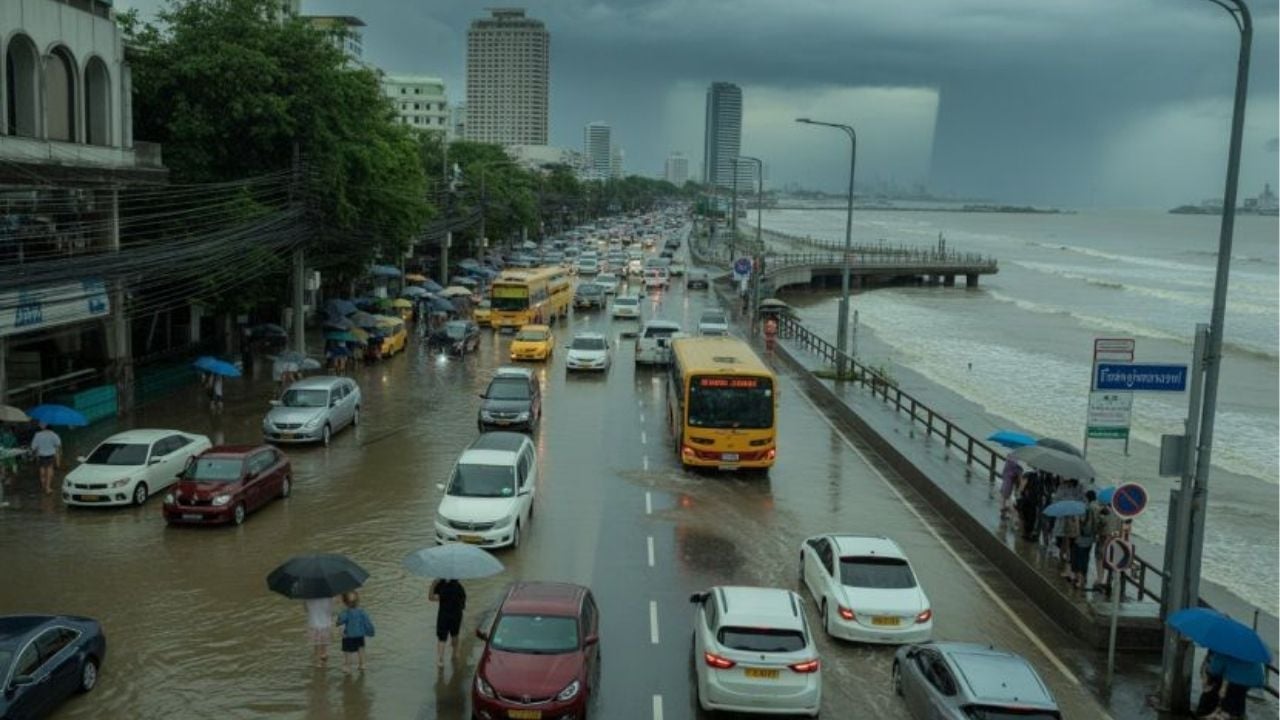
Thailand’s Meteorological Department (TMD) has warned of heavy rain, flash floods and rough seas as the monsoon brings thunderstorms across multiple regions.
The monsoon trough remains active over the North and upper Northeast, while moderate southwesterly winds prevail over the Andaman Sea, Thailand and the Gulf. According to the TMD, thunderstorms are expected nationwide with isolated heavy rainfall in northern and northeastern provinces.
Officials warn that accumulated rainfall could trigger flash floods and overflowing waterways, particularly near foothills and low-lying areas. Mariners have been urged to exercise caution, as waves in the upper Andaman Sea are forecast to reach 1 to 2 metres, rising above 2 metres in stormy conditions. In the lower Andaman Sea and the Gulf of Thailand, waves are expected at around 1 metre, also climbing to 2 metres during thundershowers.
The weather forecast from 6pm yesterday, September 11, to 6pm today, September 12, is as follows:
The northern region will see fairly widespread thundershowers and isolated heavy rain in Mae Hong Son, Chiang Mai, Chiang Rai, Phayao, Nan, Tak, Kamphaeng Phet, Phichit, Phitsanulok and Phetchabun. Temperatures will range from 23 to 25 °C in the morning, to 32 to 34°C later during the day. Wind speeds will be 5 to 15 km/h.
In the Northeast, scattered thundershowers with isolated heavy rain in Nong Khai and Bueng Kan are expected. Temperatures will range from morning lows of 23 to 25 °C to daytime highs of 33 to 35 °C. Southwesterly winds will blow at 10 to 20 km/h.
Central Thailand will experience scattered thundershowers in Nakhon Sawan, Uthai Thani, Chai Nat, Lop Buri, Saraburi, Ayutthaya, Kanchanaburi, Ratchaburi and Nakhon Pathom. Temperatures will start at 23 to 25 °C in the morning, rising to 33 to 34 °C during the day. Southwesterly winds will reach speeds of 10 to 20 km/h.

The eastern region will see scattered thunderstorms in Nakhon Nayok, Prachin Buri, Chachoengsao, Chanthaburi and Trat. Temperatures will start from 24 to 26°C in the morning, rising to 32 to 35°C later in the day. Southwesterly winds will blow at 15 to 30 km/h. Waves will reach around 1 metre and above 2 metres in storms.
On the east coast in the South, scattered thunderstorms are forecast in Phetchaburi, Surat Thani, Nakhon Si Thammarat, Phatthalung, Songkhla, Pattani, Yala and Narathiwat. Temperatures will start from 22 to 25°C in the morning, peaking at 33 to 35°C in the day. Southwesterly winds will blow at 15 to 30 km/h. Sea waves will be about 1 metre, rising above 2 metres in thunderstorms.
On the west coast, scattered thunderstorms are expected in Ranong, Phang Nga, Krabi, Trang and Satun. Temperatures will range from morning lows of 23 to 25°C to highs of 32 to 34°C later in the day, according to the TMD.
From Phuket northward, southwesterly winds will blow at 15 to 35 km/h. Waves will reach 1 to 2 metres and above 2 metres in storms. From Krabi southward, southwesterly winds will reach speeds of 15 to 30 km/h. Waves will be around 1 metre and higher in storms.
For Bangkok and the surrounding areas, scattered thunderstorms are forecast with morning temperatures at 24 to 25°C and daytime highs of 32 to 34°C. Southwesterly winds will blow at 10 to 20 km/h.
The TMD urges residents to remain alert for flash floods and rising water, while advising all vessels to avoid storm-prone areas until conditions improve.
The story Thailand on flood alert as monsoon brings heavy downpours as seen on Thaiger News.
